Length: 10miles/16km
Estimated time: 4,5h unless you stop and have a picnic every time you see a nice spot - and there are many perfect picnic spots on this walk!
Buggies: You can take a buggy on this hike. You only have to take the paved road through the forest instead the more "adventurous" path through it.
You should definitely pack food and something to drink in your backpack. While you will be passing 2 restaurants (Gasthaeuser) and a farmhouse on this hike, they aren't open on a daily basis.
You will start in Lenningen - Schopfloch (zip code: 73252) at the "Wanderparkplatz Berg Schopfloch", which is basically a little parking lot for hikers. If you have a navigation system put in "Vordere Bergstrasse" and follow this street up the hill past the last house of the village "Schopfloch" till you see this sign:

Park your car, grab your rucksack and follow the paved road past the "Harpprechthaus". The Harpprechthaus offers Swabian food and has the reputation of being quite good. Their kitchen is open from 11:30am till 8pm but they are closed on Mondays and Tuesdays.
Pass the Gasthaus on your right and stay on the paved road, leading downhill till you come to a crossing (ignore the little roads to your left and right and stay on the main road!) where you will take a left, direction "Bahnhoefle/Reussenstein". From now on you will follow signs with a red rhomb.


After about 1,2 miles (2km) you will get to a street that you have to cross. Turn right and walk along the street on a little road for 0,1 miles till you see a little path on your left leading into the forest. Take it and walk till you come to this view at the "Wanderparkplatz Bahnhoefle".
Here you can sit on wooden benches and enjoy the view of fortress "Reussenstein". There is also a barbecue pit if you brought along some German sausages...
Take the path on your left, past the sign "Wanderparkplatz" through the forest. You will now follow the red triangle. After about 0,3 miles you will see a little path on your right, take that if you are feeling a bit adventurous, stay on the paved main road if you are doing this hike with a buggy. Both paths will merge again.
We have been on this hike 3 times (once in the rain) and taken the little path through the forest each time. Especially our children found it interesting walking through the forest. You will pass a cave and hides. The view is breathtaking and there are plenty of picnic spots.
(If you take the paved road you will get to several crossings, always stay straight till the road splits. Take the road on your right. This is also the spot where you will end if you took the path through the forest.)
After merging again with the broader path walk in the right direction for about 0,3 miles (500m). On the right you will see another small path that you will take. This path will lead you out of the forest (follow the red triangle!) up through a meadow to a paved road. Take a right and follow it. (If my memory serves me right this is the only part that is not perfect if you are using a buggy.)
...and walk...
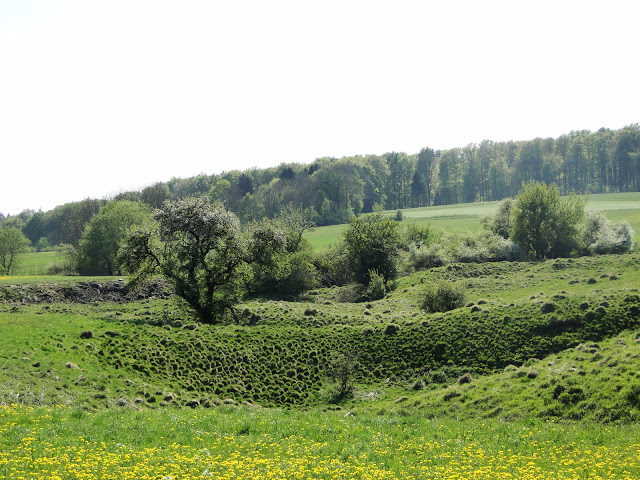
...but the landscape will be so charming that you really don't mind, even if it starts to rain...
...you will pass the "Waldparkplatz Moenchberg" and another barbecue pit, just in case you still have any German hotdogs left but if you can, keep walking till you come to a street, pass it and you will see this sign on your left:
If you get here on a weekend, make sure you take a break at the "Ziegelhuette", which is a organically run farm and has the best, very best food you can imagine.
You need to take your time because here, nobody is in a rush. You should order the delicious potato salad or bread with cheese or their fantastic pies, all made right here at the farm. The farmer offer slices of apple-, cherry and pear pies in different variations. Often they run out of them and later, towards the afternoon, there will be none left, but really, if you can, try any of them - they are all unbelievably good.
After your belly is full and you had a second cappuccino return your dishes to the farmer and continue your hike. (You will be a lot slower from now on...)
You will pass the farm house and after a few feet come to a huge sign explaining the "Naturschutzgebiet Randecker Maar".


Take the road on your left and follow it till you hit a street. Cross it and take the bike path on your right (towards "Ochsenwang".) After you enter the village of Ochsenwang you will take the "Buehlweg" on your left. After only a few steps you will turn again left and walk along the little paved path through the meadows...


You will stay straight, pass several crossings till you come to the sign "Naturschutzgebiet Schopflocher Moor" on your left. Walk across the field till you come to the marsh. Here you will use the wooden boardwalk...
Once you have walked through the marsh you will arrive at the "Otto-Hofmeister-Haus", a restaurant that serves a variety of food. We went there during the week when the "Ziegelhuette" was closed. Daughter really liked the "Swabian Spaetzle".
If you need to use the bathroom but don't want to eat anything they charge you 50cents.
:)
If you just want to keep on walking, take a right, once you are out of the marsh (the Gasthaus will be on your left) and follow the red rhomb.


You will come upon a cross made out of stone and this sign. Take a left towards "Bahnhoefle".
When you come to a street, cross it and keep following the same path up the hill. When it splits take the one on the left and stay on it for several miles. You will again walk along meadows and a forest. There is an enormous variety on plants and flowers here, some of them unique to this area.
Walking downhill you will come to another street ("Wanderparkplatz Kohlhaeute" will be to your left).
Cross it and follow the sign to the "Harpprechthaus". The road will lead you to the right, towards a forest. You will walk upwards till you come to a second cross made out of stone.
Follow the path and after about 0,5 miles (800m) you will arrive...
...at the same spot you started.
This is my favorite hike in the Swabian Albs. One that is so interesting and varied that you never realize how far you are actually walking.


No comments:
Post a Comment